Hello everyone, dear friends! Today I’ll show you how to open a portal to America.
I found the instructions on a long-forgotten forum; I'll show them to you now.
You take a plate, and then we stack the cookies on it.
Now, place a marshmallow on each cookie.

Now I need to buy some super American chocolate chip cookies.
Spread Nutella onto this cookie.

And now, we place this cookie onto our creation.

And now, we put it in the microwave for a minute.

Now this turned out well. All that's left is to add a few ingredients.

Add the Kinder and the cheese nachos.
Well, that's it. Now you can
I'm going to eat this now, and then we'll see if I really make it to the USA.
Also, while you eat, be sure to turn on the US anthem.

Oh, I think it worked! I'm in the USA!
In the next post, I’ll meet Trump!
The name Muhammad has become the most popular among newborns in Europe
According to the statistical service World of Statistics and national bureaus, the name Muhammad and its variants are confidently leading in the ratings of male names in the largest cities of the European Union and the UK.
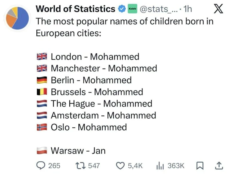
According to the publication of the World of Statistics account on the social network X, the name Muhammad took first place among the names for newborn boys in London, Manchester, Berlin, Brussels, The Hague, Amsterdam and Oslo. At the same time, the traditional name Jan remains the most popular in Warsaw, which distinguishes the Polish capital from Western European metropolises.
Especially impressive statistics were recorded in the UK. According to the Office for National Statistics, in 2024 in England and Wales, 5,721 babies received the name Muhammad (in this spelling) - this is 23% more than a year earlier. The name surpasses the traditional favourites Noah and Oliver for the second year in a row. Taking into account the different spellings (Mohamed, Mohammad, etc.), almost 3% of all newborn boys in the region receive the name of the prophet.
Austria became the record holder in terms of growth rates: for a quarter of a century, the number of newborns with this name increased by 732%. Today, every two hundredth Austrian baby is Muhammad. In Ireland, the increase was 372%, in France - 127%, in Belgium every hundredth newborn receives a name.
Nevertheless, it is obvious: the name Muhammad has firmly entered the European name, becoming one of the most striking markers of demographic changes on the continent.
So let's imagine that Germany won.
1. How?Bulgarian soldiers held back the Russian army in East Prussia and...
The commandant of Paris did not think to transfer the Moroccan division by taxi to the front, the Germans defeated the French and took Paris, led France out of the war, etc. etc.
2. Why? And what does the world look like?
It's 1929. Let's start with France and the Benelux. Belgium became a vassal of Germany, France lost part of its territories: Dijon (German), Picardy, Artois and Champagne (German France). Fascists came to power there.
Britain split, and the Communists came to power in England.
Italy got Nice
Romania received Moldavia, Austria-Hungary and Bulgaria divided Serbia.
The Ottoman Empire gained territories, but they soon separated.
The Russian Empire... Get to know each other.
The Teutonic Duchy is a German vassal in the Baltic States
The Kingdom of Belarus is a vassal of Germany in Belarus
The Kingdom of Ukraine is a vassal of Austria-Hungary in Ukraine
Don, Kuban, Kalmykia and Terek Cossacks - Cossack states (Kalmykia is semi-Cossack)
The United States of the North Caucasus, Azeybarjan, Armenia and Georgia are republics in the Caucasus.
Russia. The whites won in Russia, and Nicholas 3 (aka Nikolai Nikolaevich Jr.) now rules there, but the emperor is already old and he has no children. Besides, not everyone likes the monarch who was elevated by the Germans (they demanded either to crown him or to refuse German help) to the throne.
Siberia. And there is a military junta, whose leader is Kolchak, who did not accept that power had slipped out of his hands because of the interventionists.
I am not in the mood to do other parts of the world yet, except for Africa, which has almost completely either been decolonized or has become a Mittelafrica. There was also decolonization in the colonies of the Entente countries for obvious reasons
Let’s have a butcher’s at Trump’s politics, shall we? What the bleeding hell is this geezer up to? It’s been a right palaver since he swaggered back onto the scene, and I reckon it’s high time we unpicked the absolute omnishambles of it all. The big question floating about like a bad pong is this: is he genuinely making pals with Putin while giving Volodymyr Zelensky a proper two fingers? Let’s dive into the muck and see what’s what.
First off, Trump’s bromance with Putin’s got tongues wagging like nobody’s business. He’s forever banging on about how they’re thick as thieves — sorry, “very good friends” in his words — dropping hints they’ve got some clandestine understanding us mere mortals can’t fathom. Back in the day, he’d waffle on about how Putin’s a “strong leader” and all that malarkey, and now it’s like he’s itching to rekindle that dodgy spark. You can almost picture him sending Putin a cheeky WhatsApp: “Fancy a pint and a plot, mate?” Meanwhile, Russia’s still kicking the snot out of Ukraine, and Trump’s acting like it’s all a bit of a lark. It’s not just cosy — it’s bloody disconcerting. Is he so enamoured with the Kremlin’s iron fist that he’s willing to turn a blind eye to the carnage? That’s the rub, innit?
Then there’s poor old Zelensky, who’s copping it from Trump something chronic. The Ukrainian prez is out there, knackered, trying to fend off Putin’s tanks with whatever scraps the West chucks his way, and Trump’s over here slagging him off like he’s the villain in a poxy Bond flick. He’s called Zelensky a “dictator” and a “salesman” — proper harsh, that — while banging on about how Ukraine’s the one to blame for getting invaded. Blimey, talk about topsy-turvy! You’d think Zelensky nicked Trump’s lunch money, not led a nation through a sodding war. It’s a right stitch-up — Trump’s got no qualms about kicking a bloke when he’s down, especially if it means scoring points with his MAGA lot or, dare I say, his Russian pen pal.
What’s the game plan here, though? Some reckon Trump’s just posturing, flexing his macho credentials to look like the big kahuna who can hobnob with the world’s tough nuts. Others say it’s more nefarious — maybe he’s got a quid pro quo simmering with Putin, some backroom deal we’ll only twig when the proverbial hits the fan. Either way, his politics are as perspicuous as a fogged-up windscreen in a downpour. He’s not exactly obfuscating his leanings, mind you — he’s loud and proud about fancying Putin over Zelensky — but the why of it all’s a proper head-scratcher.
Let’s not kid ourselves: Trump’s never been one for the subtle art of diplomacy. He’s all bluster and bravado, a bit like a pub bore who reckons he’s got the world sussed after a few pints. But this Putin-Zelensky lark feels like more than just hot air. It’s got a whiff of realpolitik about it, a calculated tilt towards Moscow that’s got folk twitchy. Is he daft enough to think cosying up to Russia’s dictator will make America look strong? Or is he just so chuffed with authoritarian vibes that he can’t help himself? Whatever it is, it’s a far cry from the plucky, stand-up-for-the-little-guy rhetoric he flogged to his base.
In the end, Trump’s politics are a right mishmash — a chaotic stew of ego, grudges, and some seriously questionable mates. He’s making pals with Putin while demeaning Zelensky, and it’s anyone’s guess what he’s hoping to cop out of it. One thing’s for sure: it’s a bloody weird way to run a show, and the rest of us are just gawping, trying to suss out the next daft twist. What do you lot reckon — has he lost the plot, or is there some method in this madness?
* * *
Now, let’s chuck Elon Musk into this mad mix. The Tesla tycoon’s gone from being a bit of a lefty oddball to Trump’s right-hand man quicker than you can say “SpaceX.” Since he threw his weight behind Trump in 2024 — dishing out dosh and turning X into a MAGA megaphone — he’s become a proper Svengali in the president-elect’s orbit. Musk’s not just a mate; he’s a bloomin’ puppet master. Word is, he’s been glued to Trump’s side at Mar-a-Lago, whispering in his ear about everything from cabinet picks to slashing government red tape. Some reckon Musk’s the one nudging Trump towards this Putin-friendly, Zelensky-bashing stance — after all, he’s got his own murky ties with Russia and China to think about. Tesla’s big in Beijing, and Starlink’s a lifeline in dodgy hotspots — could be he’s got a vested interest in keeping the peace with the big lads.
The Musk-Trump relationship’s a proper rollercoaster, innit? They’ve gone from trading barbs — Trump once called him a “bullshit artist” — to being thick as thieves. Musk’s shelled out over $250 million to get Trump back in the White House, and now he’s co-running this “Department of Government Efficiency” malarkey, which is basically a licence to hack away at anything he fancies. Trump’s lapping it up, calling him a “star” and letting him sit in on calls with world leaders like Zelensky and Erdogan. It’s a quid pro quo for the ages — Musk gets clout and a chance to dodge pesky regulations, while Trump gets a billionaire cheerleader with a knack for making him look like a disruptor. But it’s got folk twitchy: is Musk steering Trump’s foreign policy to suit his own empire, or is Trump just using him as a shiny prop? Either way, it’s a bromance with some serious heft.
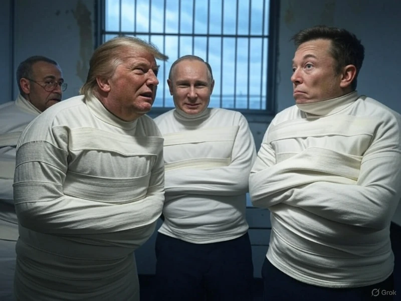
What Do You Think About Trump’s Putin-Zelensky Antics?1
For this post, I asked Chat gpt to come up with and describe what could happen to different countries in the future. I don't want to add countries by type: Russia, Ukraine, Israel, Taiwan, Palestine, Syria, so that there won't be any political disputes in the comments.
In 2054, taking into account all current factors and potential future events, Iran has probably shaped its territorial borders in accordance with its political, economic and geopolitical expansion.
Territories under Iranian control:
Iran in 2054 is likely to include a significant part of southwestern Iraq, including important oil fields and ports on the Persian Gulf. This will allow Iran to control oil and gas supplies in the region, strengthening its economic and political influence.
In addition, Iran may have acquired control over parts of southeastern Turkmenistan, including mineral deposits and strategically important mountain passes. This would allow Iran to gain access to important trade routes through Central Asia.
Finally, Iran probably holds its current borders with Afghanistan, Pakistan, and Yemen, as well as continues to control strategically important islands in the Persian Gulf such as Bahrain and Kuwait.
The situation in Iran in 2054:
In 2054, Iran is one of the largest economies in the world due to its rich oil and gas reserves, as well as the expansion of its industrial and high-tech base. The country continues to be a key player in the region, pursuing an active foreign policy and contributing to regional stability.
Iran is developing rapid technological innovations, including big data, artificial intelligence, and robotics. The country is becoming a center of science and research, attracting talented scientists and engineers from all over the world.
Culturally, Iran is becoming a bridge between East and West, combining the traditions of Islamic civilization with modern values and technologies. The country is becoming an important center of international tourism, attracting visitors from all over the world who seek to get to know its unique culture and history.
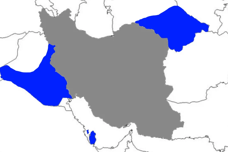
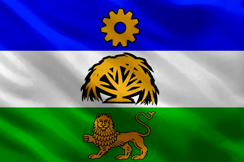
Judging by the message above, Iran may receive territories shaded in blue on the map.
In 2054, the flag of Iran will probably look like this:
The flag of Iran in 2054:
The flag of Iran in 2054 will have the shape of a rectangle divided into three horizontal stripes. The top stripe will be blue, the middle stripe will be white, and the bottom stripe will be green.
On the blue stripe, at the top of the flag, there will be a golden sun, indicating the light and glory of Iran. The sun will be shaped like a pinion, symbolizing Iran's desire for progress and technological development.
A golden palm tree will be depicted on the white stripe in the middle of the flag, which symbolizes the stability, strength and majesty of Iran. The tree will have six stems that will come out of its base, symbolizing the six core values of Iranian society.: justice, equality, freedom, democracy, progress and technology.
On the green stripe, at the bottom of the flag, there will be a golden lion, which symbolizes the strength, bravery and protective qualities of Iran. The lion will sit on its side, with its right paw raised up, symbolizing Iran's readiness to defend and protect its citizens.
The symbolism of the flag:
The flag of Iran in 2054 will symbolize the following values and principles:
* Blue color – symbolizes the light, glory and majesty of Iran.
* The golden sun – symbolizes progress, technological development and the pursuit of fame.
* White color – symbolizes stability, strength and majesty of Iran.
* The golden palm tree – symbolizes the stability, strength and majesty of Iran.
* Green color – symbolizes the strength, bravery and protective qualities of Iran.
* Golden lion – symbolizes the strength, bravery and protective qualities of Iran.
In general, the flag of Iran in 2054 will symbolize the country's desire for progress, technological development, stability, strength and majesty.
In 2054, Iran may change its name to reflect the country's new values, ideals, and status. After modernization and innovation over the years, Iran is likely to become a more secular and progressive society that prioritizes the values of freedom, democracy, and human potential.
The new name of Iran in 2054:
In 2054, Iran may adopt a new name that reflects its new status and values. The new name may be as follows:
- Islamic Republic of Persia: This name will preserve Iran's historical and cultural ties with Persia, but it will also reflect its new goals and ideals.
- The Republic of Azadi: This name will reflect the values of freedom and democracy, which will become the basic principles of Iran in 2054.
-Republic of Emami: This name will reflect the values of progress and innovation that will be key to Iran's development in 2054.
- Republic of Elam: This name will reflect Iran's historical and cultural connection with Elam, but it will also reflect its new values and ideals.
The new name of Iran is a symbolization of a new era:
The new name of Iran in 2054 will symbolize the beginning of a new era for the country, which will prioritize the values of freedom, democracy and human potential. This will reflect the changes that will take place in the country, as well as its new relations with other countries.
Other information:
After significant changes in Iran's territory and politics, Iran's population, GDP, and area are likely to change as well. Since Iran includes a significant part of southwestern Iraq, part of southeastern Turkmenistan, as well as strategically important islands in the Persian Gulf, Iran's population is likely to increase.
The population of Iran in 2054:
* The population of Iran in 2054: about 150-170 million people.
* Iran's population density in 2054: about 60-70 people per square kilometer.
* Iran's population growth rate in 2054: about 2-3% per year.
Nominal GDP of Iran in 2054:
* Nominal GDP of Iran in 2054: about 7-8 trillion US dollars.
* Iran's GDP growth rate in 2054: about 7-9% per year.
The area of Iran's territory in 2054:
* The area of Iran's territory in 2054: about 2.5-3.0 million square kilometers.
Bottom line, Iran 2054:
1. The Islamic Republic of Persia
2. Area: 1.6 million km2 –> 2.7 million km2
3. GDP: $400 billion –> $7 trillion
4. Population: 90 million –> 160 million
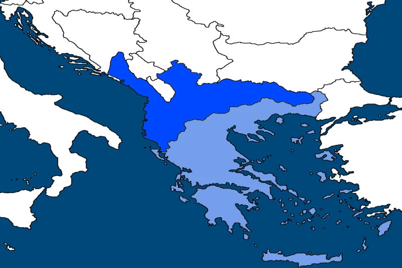
In 2054, taking into account all current factors and potential future events, Greece probably shaped its territorial borders in accordance with its political, economic and geopolitical expansion.
Territories under Greek control:
Greece in 2054 is likely to include the following territories:
* Aegean Islands: Greece continues to control all the Aegean islands, including Crete, Kefalonia, Ithaca and others.
* North Macedonia: Greece probably incorporated North Macedonia, which was formerly an autonomous republic.
* Part of the Balkan Peninsula: Greece may have included part of the Balkan Peninsula, including parts of Albania and parts of Bosnia and Herzegovina.
* Atlantic Islands: Greece probably included the Atlantic Islands, including the islands in the Atlantic Ocean that are off the coast of Greece.
The situation in Greece in 2054:
In 2054, Greece is one of the leading economies in Europe due to its rich reserves of energy resources, including gas and oil. The country continues to be a key player in the region, pursuing an active foreign policy and contributing to regional stability.
Greece is experiencing rapid technological innovations, including big data, artificial intelligence, and robotics. The country is becoming a center of science and research, attracting talented scientists and engineers from all over the world.
Culturally, Greece is becoming a bridge between East and West, combining the traditions of ancient Greece with modern values and technologies. The country is becoming an important center of international tourism, attracting visitors from all over the world who seek to get to know its unique culture and history.
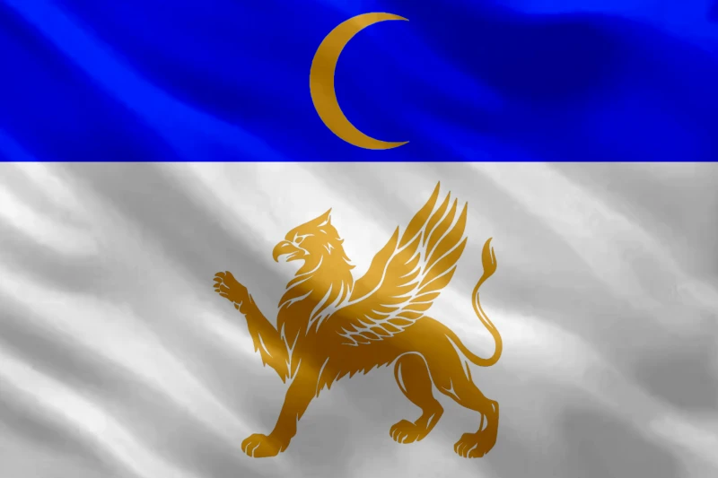
The new flag of Greece in 2054 is likely to look like this:
* The flag will have the shape of a rectangle divided into three horizontal stripes: blue, white and blue.
* On the blue stripe, at the top of the flag, there will be a golden sun, symbolizing the light and glory of Greece.
* A golden ancient Greek wheel will be depicted on the white stripe in the middle of the flag, symbolizing the progress and technological growth of Greece.
* On the blue stripe, at the bottom of the flag, there will be a golden wind symbolizing the freedom and democracy of Greece.
Symbols of the new flag:
The new flag of Greece in 2054 will symbolize the following values and principles:
* Blue color - symbolizes freedom, democracy and glory of Greece.
* The golden sun - symbolizes the light, glory and progress of Greece.
* The golden ancient Greek wheel - symbolizes the technological growth, innovation and progress of Greece.
* Golden Wind - symbolizes freedom, democracy and stability of Greece.
In general, the new Greek flag in 2054 will symbolize Greece's modernity, innovation and progress, as well as its historical and cultural heritage.
After significant changes in the politics and territorial affiliation of Greece, there will probably be changes in its name. But, in general, the name of Greece in 2054 is likely to remain the same.
The name of Greece in 2054:
* The name of Greece in 2054: remains the same - Greece.
* However, a prefix or suffix may be added to reflect the new political or territorial affiliation of Greece.
* For example, the name of Greece in 2054 could be "Greek Republic", "Greek Federation" or "Greek State".
Other information:
Following significant changes in Greece's territories and policies, Greece's population, land area, and nominal GDP are also likely to change.
The population of Greece in 2054:
* The population of Greece in 2054: about 25-30 million people.
* Population density of Greece in 2054: about 100-120 people per square kilometer.
* The rate of population growth in Greece in 2054: about 1.5-2% per year
The area of the territories of Greece in 2054:
The area of the territories of Greece in 2054: about 200-300 thousand square kilometers.
Nominal GDP of Greece in 2054:
* Nominal GDP of Greece in 2054: about 2-3 trillion US dollars.
* Greece's GDP growth rate in 2054: about 4-5% per year.
Bottom line, Greece 2054:
1. The Hellenic Federation
2. Area: 132,000 km2 –> 230000 km2
3. GDP: $240 billion –> $2-3 trillion
4. Population: 10.5 million –>
Territories and population of France in 2054:
* France in 2054 is an unstable country, with a large number of migrants who have arrived from different parts of the world.
* The territories of France in 2054 are divided into several zones, each of which is controlled by different groups of migrants and local residents.
* The population of France in 2054 is about 20-25 million people, which is a significant decrease compared to the population in 2023.
Social and economic problems of France in 2054:
In 2054, France faces a number of social and economic challenges, including instability, criminality, and corruption.
* Migrants mainly come from African and Middle Eastern countries, which leads to cultural and ethnic conflicts between different groups.
* The French economy is largely isolated in 2054, leading to a lack of investment and technological progress.
The political situation in France in 2054:
In 2054, France is a federation divided into several autonomous regions, each with its own administration and government.
* The regional governments of France in 2054 are often in conflict with each other, which leads to instability and criminality.
* The central government of France practically does not exist in 2054, and it cannot effectively govern the country due to the lack of power and control.
The cultural and educational situation in France in 2054:
In 2054, France is experiencing a cultural and educational crisis, as many schools and universities are closed or functioning inefficiently.
* Migrants mostly do not speak French, which leads to a lack of cultural exchange and integration into local society.
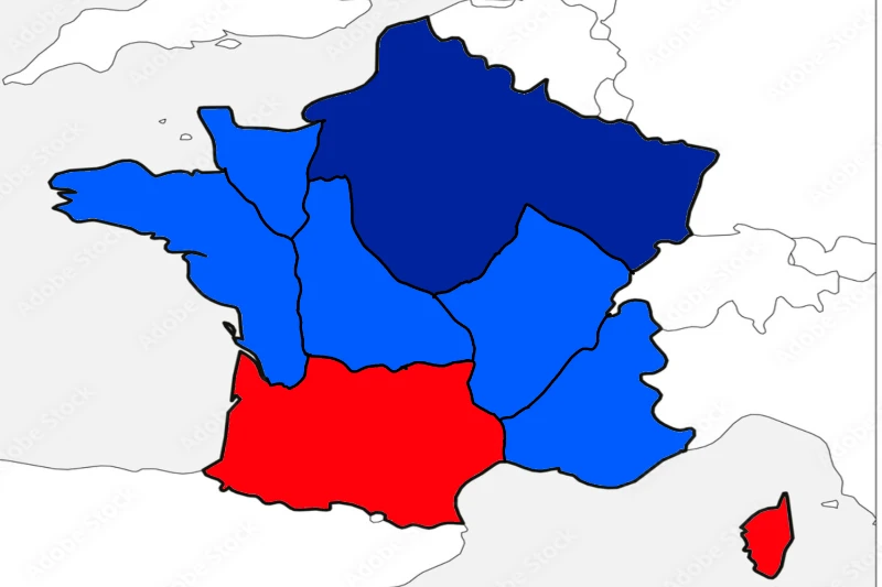
Dark blue is the main area. Blue – autonomous republics. Red is no longer part of France.
The new flag of France in 2054:
* The flag of France in 2054 will have three horizontal stripes: blue, white and red.
* The blue stripe at the top of the flag will be deeper and darker than the modern blue stripe.
* The white stripe in the middle of the flag will look like a grid of thin horizontal and vertical lines, symbolizing the connection between the different cultures and societies of France.
* The red stripe at the bottom of the flag will look like a wave, symbolizing the sea and the French tradition of navigation.
* The emblem of France, the girl Marianne, will be depicted in the center of the flag, but she will be depicted in a modern, more colorful and expressive manner.
This new flag of France in 2054 will symbolize the traditions and value of France, but it will also reflect the changes and progress in the country.
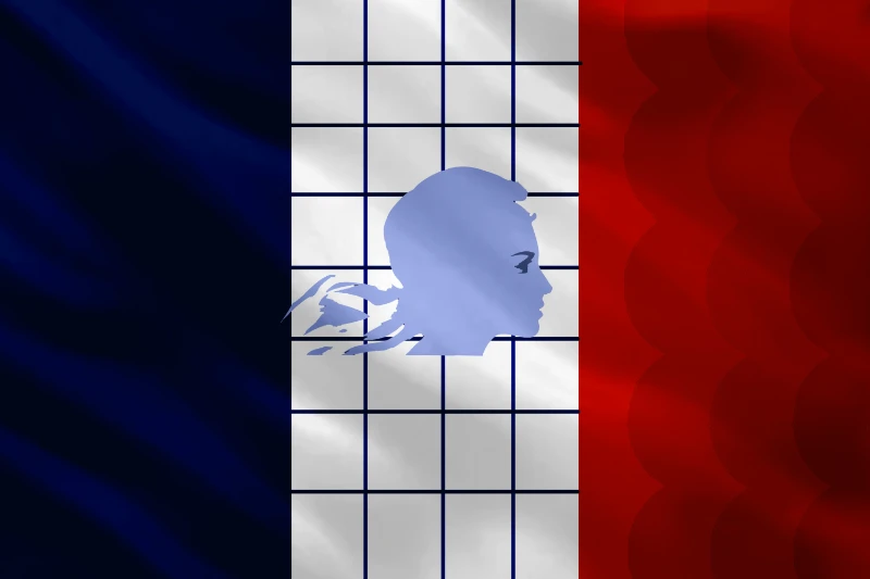
Let's imagine that after changes in the politics and territories of France, it decides to change its name.
The new name of France in 2054:
In 2054, France decides to change its name to the "New European Republic" (NER – New European Republic).
* The name "New European Republic" reflects the new political and territorial reality of France in 2054, when it becomes an unstable country due to the large number of migrants.
Official documents and symbols of the New European Republic:
* The new European Republic in 2054 has new official documents, symbols and regalia that reflect the new name and status of the country.
Other information:
Population of France in 2054:
* Population of France in 2054: about 20-25 million people.
* Population density of France in 2054: about 50-60 people per square kilometer.
* France's population growth rate in 2054: about 1-2% per year.
The area of France's territories in 2054:
* The area of France's territories in 2054: about 300-400 thousand square kilometers.
Nominal GDP of France in 2054:
* Nominal GDP of France in 2054: about 500-700 billion US dollars.
* France's GDP growth rate in 2054: about 2-3% per year.
Bottom line, France 2054:
1. The New European Republic
2. Area: 650,000 km2 –> 300,000 km2
3. GDP: $3.8 trillion –> $700 billion
4. Population: 68 million –> 25 million
That's all, if you want to suggest countries for the next posts, write in the comments.
¡Adiós!
I just want to create a post. Why not?
I'm not going to fully return to picuco, but I want to create some unnecessary posts or tests.
First of all:
Countries whose territories are divided into states:
1. Nigeria, which includes 36 states.
2. Mexico, it consists of 31 states.
3. Brazil, which consists of 26 states.
4. India, which consists of 28 states.
5. Venezuela, which includes 23 states.
6. Malaysia, which includes 13 states.
7. Australia has 6 states in its composition.
8. Micronesia, it consists of only 4 states.
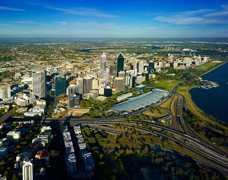
1. Western Australia(Australia) 2,529,875 km2 The largest of the Australian states, occupying a third of the continent's territory.
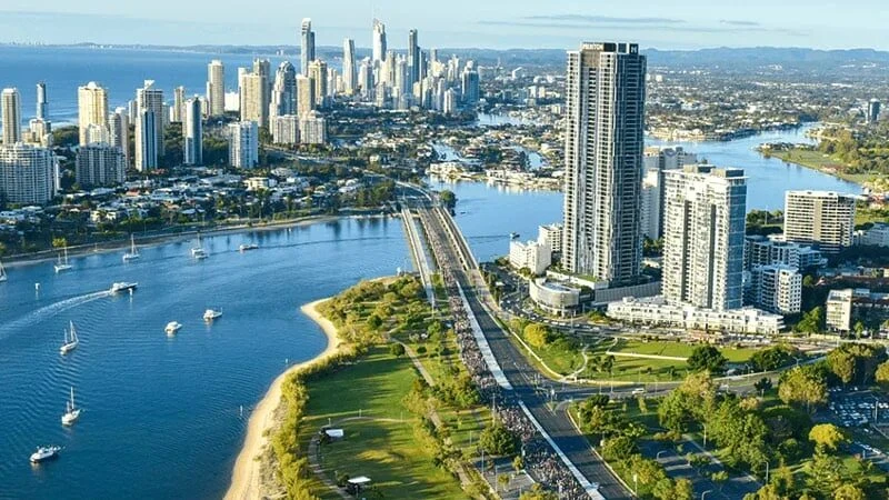
2. Queensland (Australia) is a 1,730,648 km2 state in the northeast of the Australian mainland. The capital and largest city is Brisbane.
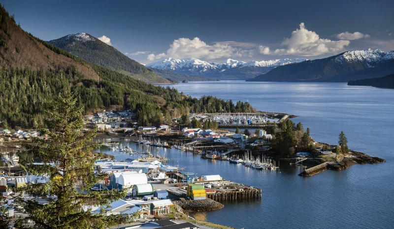
3. Alaska (USA) 1,723,337 km2 is the northernmost and largest state in the USA. It is located in the north-west of North America. It has a maritime border with Russia in the Bering Strait.
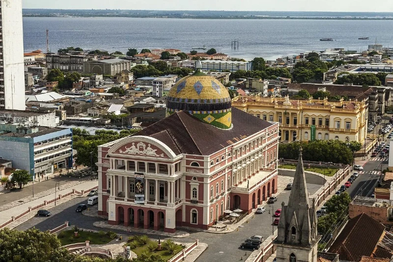
4. Amazonas (Brazil) 1,559,161 km2 The administrative center is the city of Manaus, the largest state in Brazil by area. It occupies more than 18 % of the country's territory
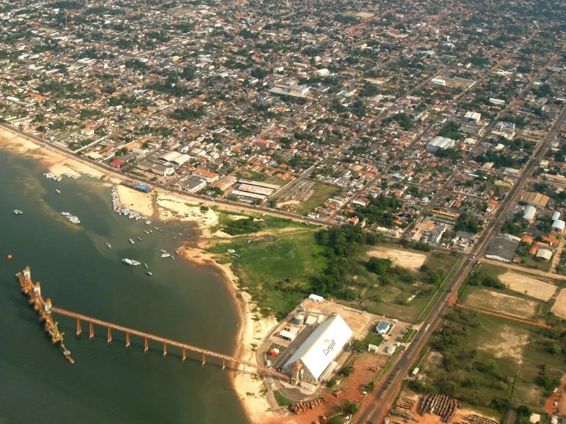
5. Para (Brazil) is a 1,247,950 km2 state in the north of Brazil. The administrative center is the city of Belen.
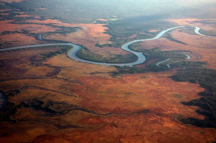
6. The Northern Territory (Australia) is 1,349,129 km2 a federal subject within Australia, in the north of the mainland of the country. The capital and largest city is Darwin.
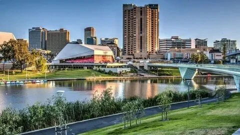
7. South Australia (Australia) 983,482 km2 is a state in the center of the southern part of Australia. The administrative center is the city of Adelaide.
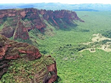
8. Mato Grosso (Brazil) is a 903,329 km2 state in the central part of Brazil. The administrative center is the city of Cuiaba. Mato Grosso is the third largest state in Brazil by area.
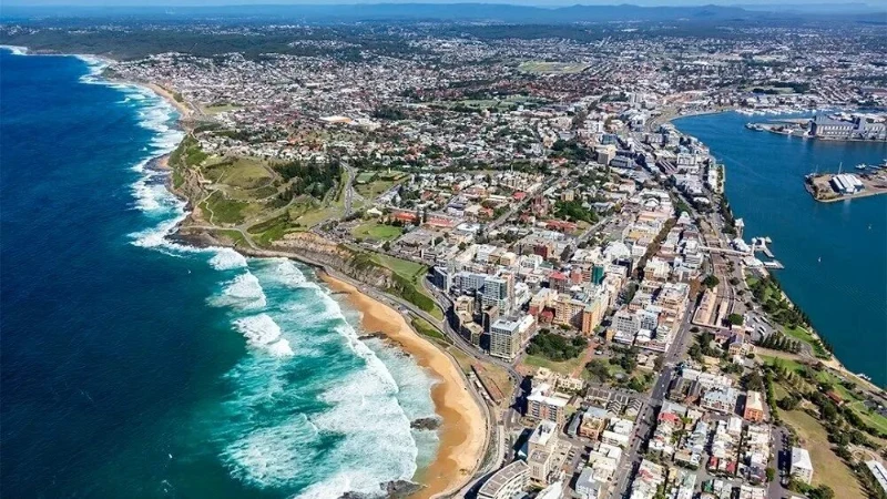
9. New South Wales (Australia) is an 800,642 km2 state in southeastern Australia, the oldest and most densely populated administrative-territorial unit of the country.
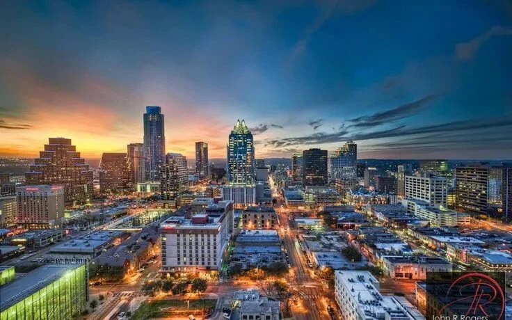
10. Texas (USA) is a 695,662 km2 state in the south of the USA. The state capital is Austin. It ranks 2nd in terms of territory in the United States.
Among these states are:
- 5 states from Australia
- 3 states from Brazil
- 2 states from the USA
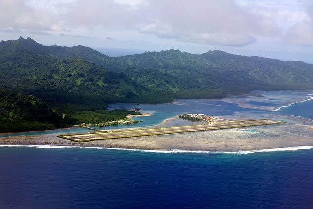
1. Kusaie (Micronesia) 109 km2 One of the four states of the Federated States of Micronesia. It is located in the east of the country.

2. Yap(Micronesia) 122 km2 It includes the Yap Islands and atolls to the east and south of the islands. It is located in the west of the country.
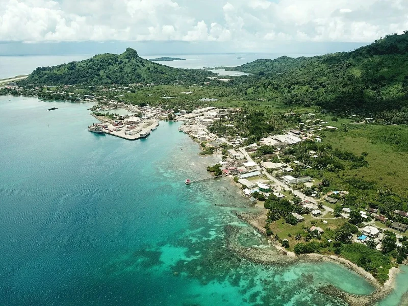
3. Chuuk (Micronesia) 127 km2 is located in the western Pacific Ocean 1,440 km east of Yap Island.
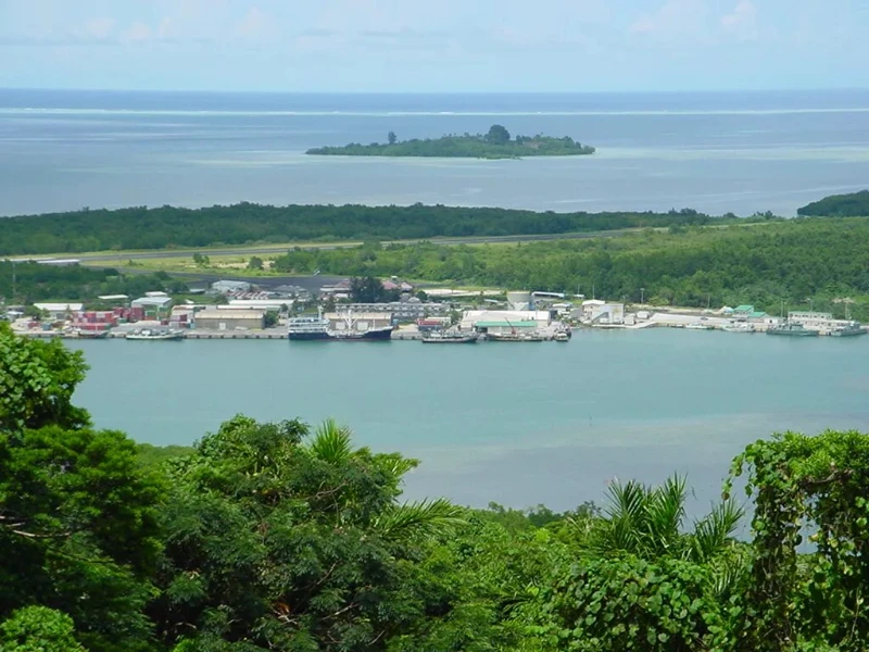
4. Pohnpei (Micronesia) 344 km2 Until 1984, the state was called Ponape. It is located in the central-eastern part of the FSM on the island of Pohnpei and small coral islands
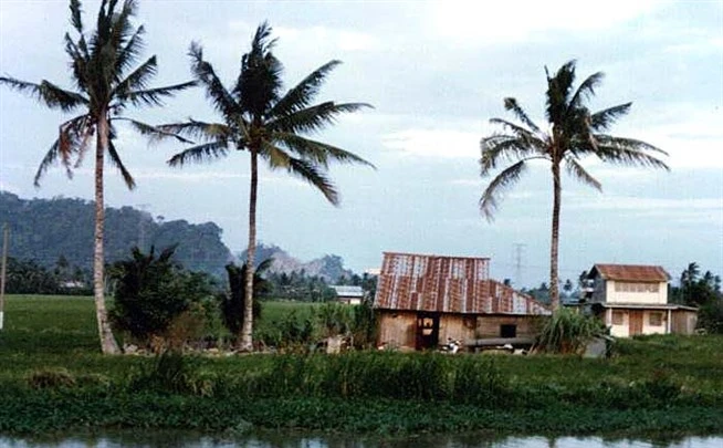
5. Perlis (Malaysia) is a 795 km2 state in Western Malaysia, in the extreme northwest of the Malacca Peninsula.
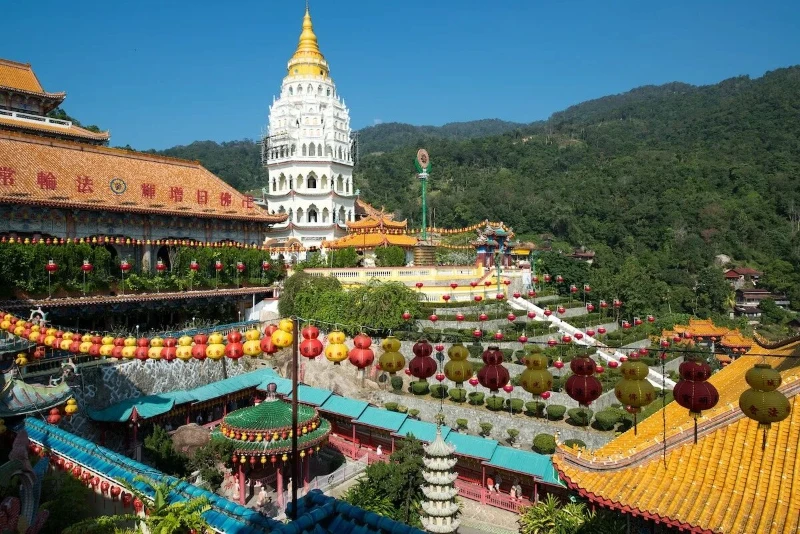
6. Penang (Malaysia) is a 1,031 km2 state in Malaysia, located on the northwestern coast of the Malacca Peninsula, in the Strait of Malacca.
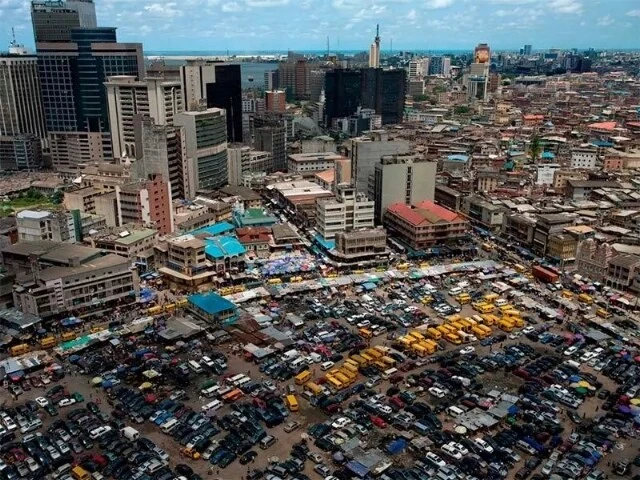
7. Lagos (Nigeria) is a 1,171 km2 state in southern Nigeria. It is the smallest in area and the second most populous (after Kano) among the states of Nigeria, as well as one of the most economically developed states.
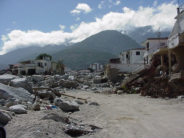
8. Vargas (Venezuela) 1,496 km2 One of the 23 states of Venezuela. The administrative center of the state is the city of La Guaira. The population is 352,920 people.
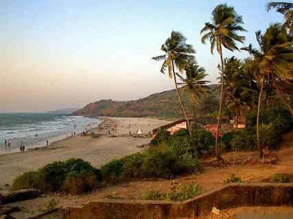
9. Goa (India) is a 3,702 km2 state in southwestern India, the smallest among the states in terms of area and the 26th (out of 29) in terms of population. A former Portuguese colony on the Indian Subcontinent.
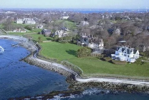
10. Rhode Island (USA) is a 4002 km2 US state, part of the New England region and located on the Atlantic Ocean. It is the smallest state in the United States by area.
Among these states are:
- 4 states of Micronesia (all its states)
- 2 state of Malaysia
- 1 state of Nigeria
- 1 state of Venezuela
- 1 state of India
- 1 US state
I hope you enjoyed this post. You can suggest ideas for posts in the comments.
Did you know that there are states bigger than Alaska?0

