J. R. R. Tolkien wrote: "I wisely started with a map, and made the story fit (generally with meticulous care for distances). The other way about lands one in confusions and impossibilities, and in any case it is weary work to compose a map from a story — as I fear you have found".
The maps of Middle-earth deserve a special attention, right? I will show you fragments and talk about the main thing: how geographical objects relate to each other.
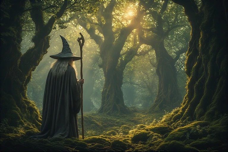
Let's start with forests. They have an important role to play.
Top 3 largest forests in Middle-earth by area:
1. Mirkwood
2. Fangorn
3. Lorien
And now remember how much time the characters spent in each of these forests.
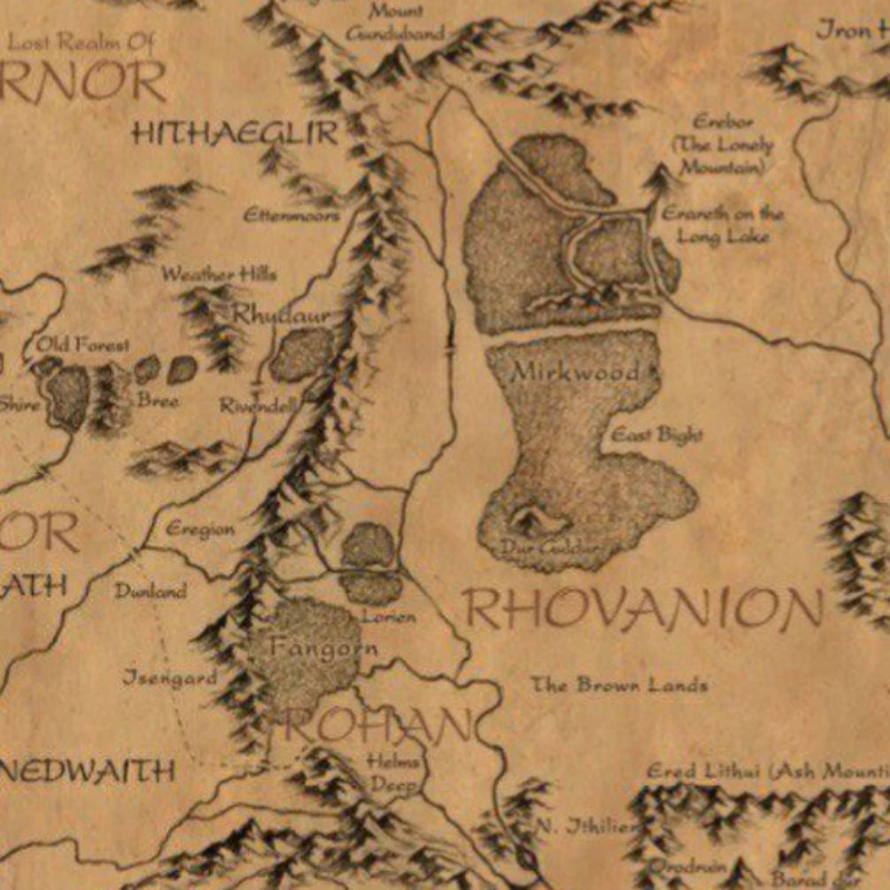
Look at the map. That's why you're here.
The second thing I want to draw your attention to is the Misty mountains. It is a mighty mountain range that cuts Middle-earth in two. But the mountains don't just split the continent. This is where Frodo and Bilbo's paths diverge.
There are 77 years between their journeys. Let's see their itineraries on one map. They reached Rivendell by the same route. Then they tried to cross the mountain range (Bilbo succeeded, but Frodo had to go under the mountains, through Moria). After they crossed the Misty Mountains, Bilbo headed northeast to the Lonely Mountain, Frodo headed southeast to Mordor.
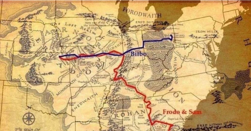
A kind person drew the routes of Bilbo and Frodo on the same map. Thanks.
Now let's look at the location of human lands. Gondor and Rohan are very close neighbors and, fortunately, allies.
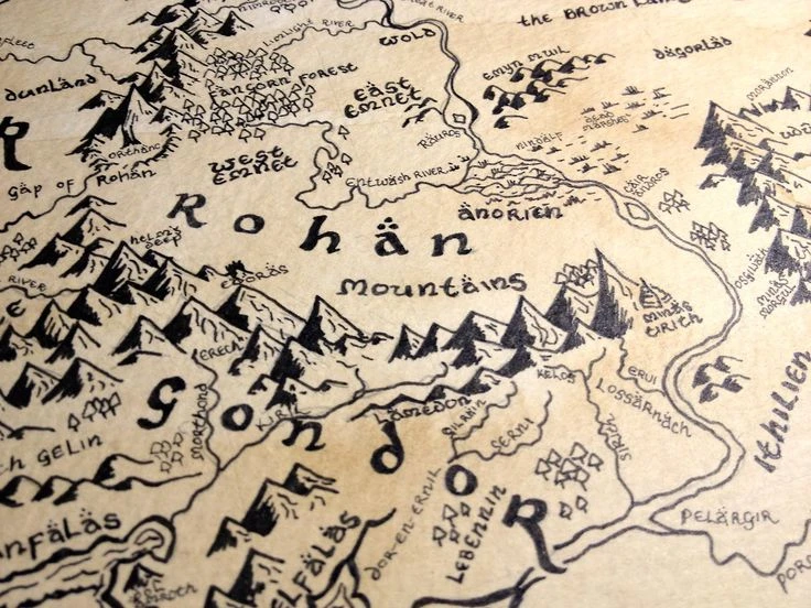
Where was Gondor when the Westfold fell?!
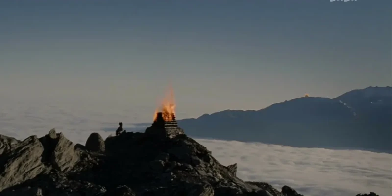
In the year 2510 of the Third Age, the Beacon-hills were created as a means of communication between Gondor and Rohan. The system could be used in both directions.
During the War of the Ring, the beacons on the northern Beacon-hills were lit on March 9 when news came to Minas Tirith from Lebennin that a large fleet Corsairs of Umbar were coming near to the Ethir Anduin. As the Rohirrim rode to Gondor's aid through Anórien they travelled close to all seven northern Beacon-hills on their way to Minas Tirith.
Wonderful!
Keep your allies close and your enemies even closer...
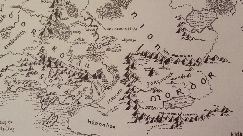
Let's go back to the map. If we zoom it out, we'll find another neighbor, and a pretty dangerous one. Gondor and Rohan have a common border with Mordor.
Surprise!
That's all!
This was the cursory acquaintance with the map of Middle-earth. We glanced at the most notable objects without going into details.
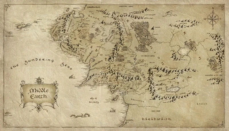
Finally, take a look at the entire map of Middle-earth, maybe you'll notice something interesting for yourself!
Look at the map, I said!
Shall we continue?2


Share:
Bestcomments (0)
There are no comments for this post yet. Want to leave the first one?